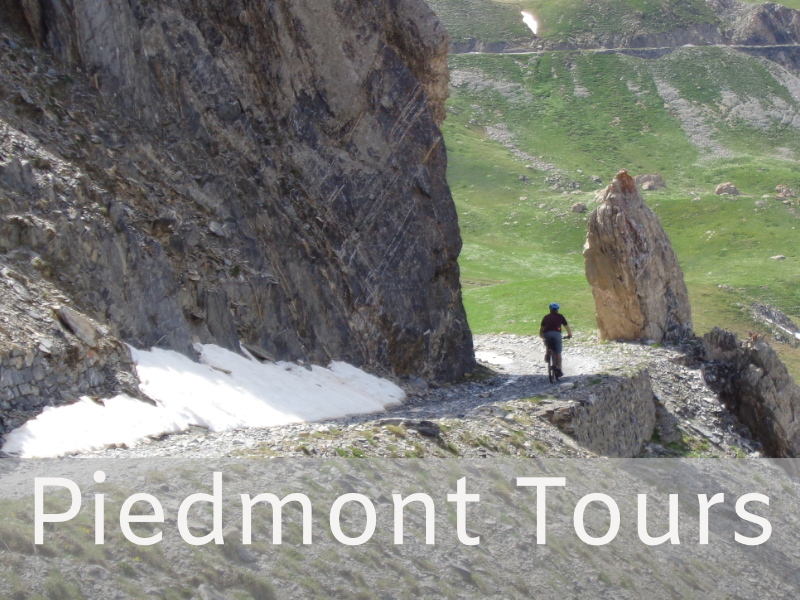
Piedmont – Routes
The name Piedmont means “at the foot of the mountains”, the mountains embraces the Piedmont territory in a semicircle from south to north.
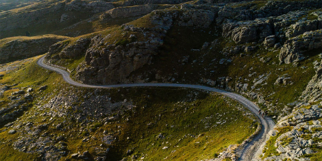
The Western Alps are a little inhabited area, far from the main roads. The isolation has allowed to preserve the mountains from mass tourism in favor of hiking and biking tourism. They are the mountains of the border between Italy and France where, since the 1700s, military roads have been built to defend the Italian borders. Incredible high-altitude gravel roads ranging from 6500 to 8000 feet above the sea level with splendid and solitary alpine landscapes, the mostincredible gravel roads in Europe.
The tour we designed runs along the Italian / French border from west to south, covering the two alpine sectors: Cottian Alps, Ligurian Alps. Our trip starts from the center of the Western Alps and reaches the Ligurian Sea.
COTTIAN ALPS
The Cottian Alps are formed by the 11 Occitan Valleys and are a wild high mountain area on the border with French region of Provence.
It is our secret alpine area, very little known by the Italians, splendid for cycling. Here we enjoy paved and unpaved roads at high altitude with no car traffic, roads made famous by the passage of the Giro d’Italia.
ALTA VAL PO à MONVISO MOUNTAIN, THE KING OF STONE
The Alps begin, we are in the solitary and rugged Occitan Valleys, the first route of the vacation is the ascent to Monviso, the King of Stone of the Alps. Easy tarmac climb to get familiar with Italian bicycles and alpine roads, at the top the display is impressive with a view of the valley and the imposing massif of the mountain. The way back is a long descent.The Giro d’Italia made this climb in 1991 and 1992, both times in the fog and the rain.
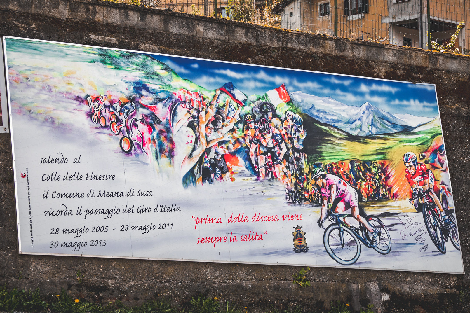
VAL DI SUSA AND VAL CHISONE à COLLE DELLE FINESTRE, WHERE GIRO D’ITALIA WENT GRAVEL
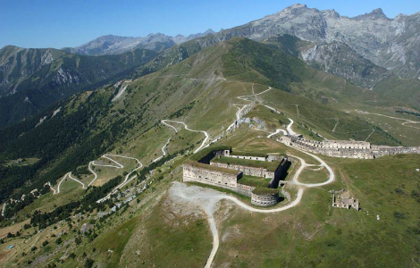
An epic ride, starting from the bottom of the Susa Valley, with an old dirt road, first in the chestnut woods and then in an incredible alpine landscape, you arrive at Colle delle Finestre at 7,500 feet to sea level after 11 miles and 33 hairpin bends. Then you descend into the Chisone Valley through the Gran Bosco di Salbertrand passing through the Forte di Fenestrelle, built in 1700 as a great defensive barrier on the French border.
The climb of Colle delle Finestre, with its 5.6 miles of dirt road, is considered by cyclists to be one of the most epic climbs in Europe, was part of the rout of the Giro d’Italia in 2005, 2011, 2015, 2018, feared by professionals, is been fundamental for the final victory.
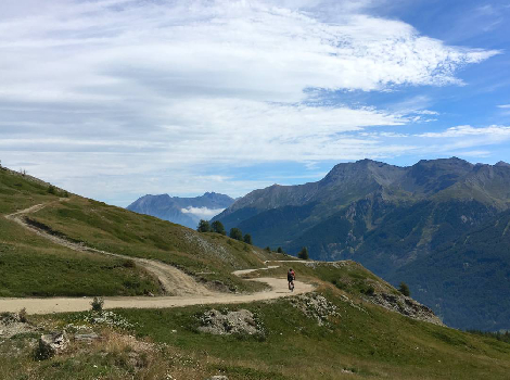
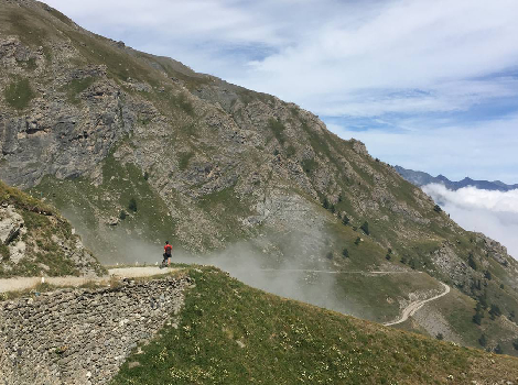
At Colle delle Finestre, those not yet happy with the climb will be able to extend the 19-mile tour and take the Strada dell’Assietta, a splendid military ridge road with a splendid alpine landscape at an altitude of between 6500-8500 feet to sea level.
VAL VARAITA à STRADA DEI CANNONI, GOING UP THE SKY ON THE MILITARY ROAD
High altitude military road (up to 7500 feet to sea level), built around the mid-18th century in the Napoleonic period, for the transport of troops and materials, it was never used because the fighting resolved around the walls of the city of Cuneo .
The Strada dei Cannoni is a long and very panoramic traverse that reaches the Sampeyre Pass from the lower valley, remaining on the Maira / Varaita watershed, passes through woods, meets grazing cows and seems to rise in the deep blue sky.
After this crossing, once you reached Passo Sampeyre, the itinerary continues towards the high pastures of Elva and return to the valley through a spectacular road overhanging the narrow Vallone di Elva.
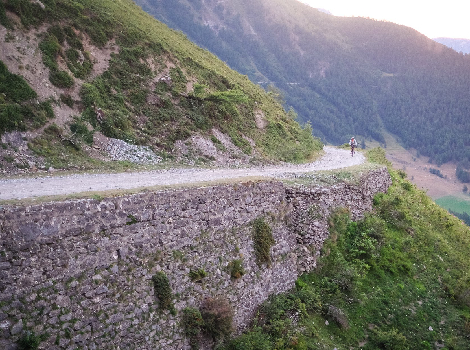
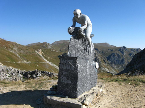
VAL MAIRA AND VAL GRANA à FAUNIERA PASS, THE LEGENDARY MARCO PANTANI’S CLIMB
The road we love the most in the Western Alp, is the dirt crossing of the Gardetta plateau, 19 miles of ups and downs between 7500 8500 feet to sea level, an infinite ridge in the shadow of the Rocca la Meja mountain, spectacular idyllic landscapes, the kingdom of the Marmots. The only bad news is that you have to gain the access door of the plateau on long climb up to the Faunera Pass also called Passo dei Morti (Death Pass, this name is due to the many soldiers who fell in a bloody battle in 1744, when the Franco-Spanish soldiers attempted to pass the pass to besiege the city Cuneo)
The climb to the Passo della Fauniera, recalls the fantastic success of Marco Pantani at the 1999 Giro d’Italia. A climb in a lonely environment of high mountains almost lunar, the true essence of the Occitan Alps.
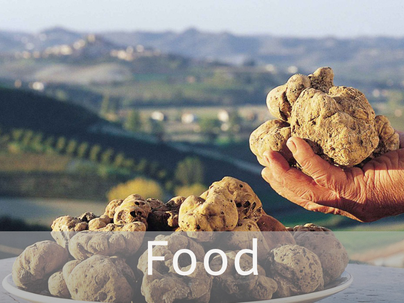
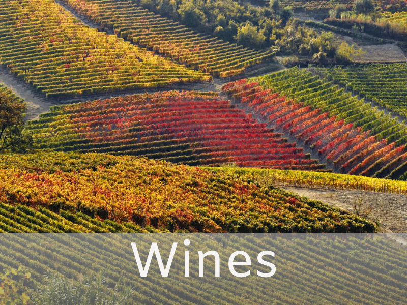
Descent to Val Grana, a long valley full of grazing cows from whose milk Castelmagno cheese is produced, one of the best Italian cheeses (but this is another story that I will tell you when we talk about food)
LIGURIAN ALPS
We spend the last two days in the Ligurian Alps, we pass from high mountain karst landscapes to hills with Mediterranean vegetation on the Ligurian Sea.
The first day we ride the famous Via del Sale, the second our secret paths in search of small villages clinging to the mountain.
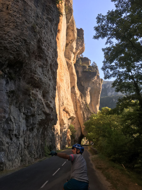
VIA DEL SALE à GRAVEL ROAD FROM THE MOUNTAIN TO THE SEA
We move towards the sea through the old gravel roads of the Maritime Alps called “Via del Sale”.
The Via del Sale are ancient routes that start from the Ligurian coast and pass from Piedmont and France to Switzerland. Until 1300, these roads were used by shepherds, pilgrims, mule drivers, traders and travelers who from the West settle and from nearby Provence reached, using the Alpine passes, Piedmont and Northern Europe, creating dense networks of exchanges.
Traders who carried salt, in addition also brought the fish preserved in salt, the “anchovies” caught in the Ligurian sea, worked with salt and transported to be sold along the way. The name of this traders was “Acciugai”.
The routes of the “Salt Roads” start between Nice and Imperia, flow into the mandatory passage of Colle di Tenda (6300 feet) from where they continue towards Northern Europe. Today the “Salt Roads” have lost their commercial connotation, they have become one of the most renowned European areas for cycling, hiking, motorcycling and horse trekking. Very fascinating dirt roads, one of Europe’s gravel paradise.
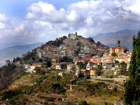
WEST LIGURIAN ALPS à PRETTY PERCHED VILLAGES IN THE FORESTED HILLS
“Our secret itinerary” from the sea climbs through narrow streets and crosses the ancient villages clinging to the top of the hills: Seborga, Perinaldo, Apricale, Bajardo and Castel Vittorio.
Red dirt roads, all immersed in the fragrant Mediterranean scrub (gariga, machis) in the midst of olive and oak woods, five climbs, five descents, in each village a place to eat and where to take a breath before the next climb.
A network of small roads, very little traffic, this is the Ligurian inland unknown even to many Italians. The last day of a rewarding and demanding week, nothing better than a mega goodbye aperitivo by the sea.